Spatial intelligence
T.I.E. — Terrain Intelligence Engine
T.I.E. is Draugr's real-time spatial intelligence layer. It processes live units, incidents, hazards, mission zones, and environmental overlays to produce a deterministic operational picture.
No guessing. No automation. Truth-first spatial computation for dispatchers, responders, and HOA admins. Complements official GIS — does not replace CAD or county mapping systems.
Operational map
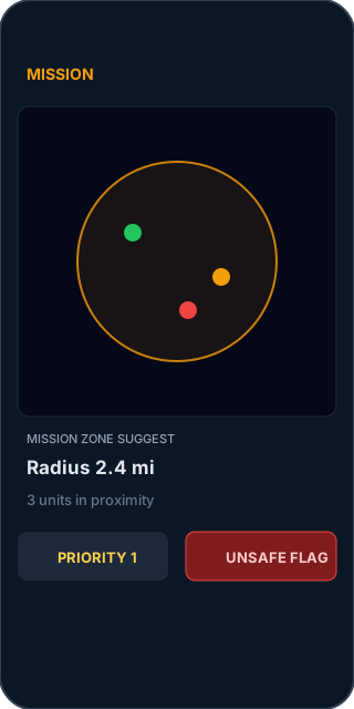
Live units, incidents, hazards, and mission radius on an operational picture. High-contrast layers for flood, evacuation, and HOA boundaries.

Core functions
Deterministic spatial computations — every output traceable through a reasoning chain. Humans confirm dispatch; T.I.E. never auto-executes.
- Safe route compute
safe_route_compute - Hazard overlap detect
hazard_overlap_detect - Unit risk highlight
unit_risk_highlight - Incident cluster detect
incident_cluster_detect - Mission zone suggest
mission_zone_suggest - Unit proximity score
unit_proximity_score - Priority score compute
priority_score_compute - Unsafe action flag
unsafe_action_flag
Live charts
Senior-safe, high-contrast charts for incident volume and unit availability — large type, zero clutter.


How T.I.E. works
- Live unit stream — position, status, and risk state from connected field units.
- Live incident stream — structured events from Action Alert and command feeds.
- Static overlays — HOA boundaries, flood zones, evacuation zones.
- Hazard polygons — storm surge, road closure, and environmental hazard layers.
- Mission geometry — radius, corridor, and zone definitions for active missions.
- Deterministic reasoning chain — scored outputs with full trace; no black-box guesses.
- Senior-safe visual output — large fonts, high contrast, one-tap actions.
User experience
- High contrast
- Large fonts
- One-tap actions
- Zero clutter
- Zero drift
Why it matters
- Faster decisions
- Fewer errors
- Safer units
- Clearer awareness
- Lower cognitive load
PWA screens
Mobile-first interfaces for dispatchers and field leads. Text-forward mockups — production UI ships with Action Alert and licensed T.I.E. deployments.